isprs annals IV 2 W4 227 2017
Teks penuh
Gambar
Garis besar
Dokumen terkait
In this paper, we present a method for using the estimated precipitable water (PW) to mitigate atmospheric phase delay in order to improve the accuracy of land-deformation
ISPRS Annals of the Photogrammetry, Remote Sensing and Spatial Information Sciences, Volume IV-2/W4, 2017 ISPRS Geospatial Week 2017, 18–22 September 2017, Wuhan, China... GAOFEN-3
This paper proposes an indoor navigation approach that considers obstacles in 3D space, reads the geometric and semantic information of entities such as obstacles
Camera translation estimation result, Corridor 2 (Left image: actual camera path, right image: our estimated result) Figure 8 shows our estimated camera translation in the
The ability to evaluate the variation of isovist properties is very important, as it allows to understand how visibility varies along a path and, therefore, define its complexity
For reference we show the precision and completeness of the ob- tained mesh (with 30k faces), of a Poisson surface reconstruction (Kazhdan and Hoppe, 2013) (6.3M faces), of
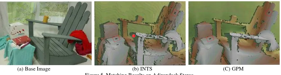
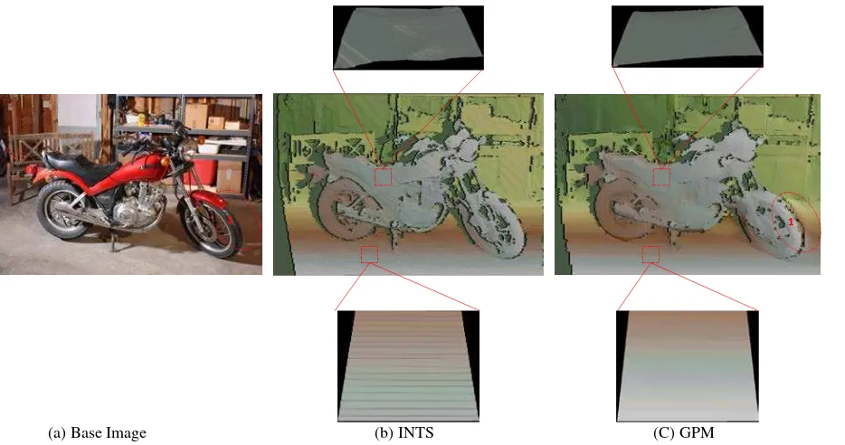
During the computation process of CGBA of large and complex image blocks, such as Dunhuang wall painting images, an effective preconditioning method is needed for
OCCUPANCY MODELLING FOR MOVING OBJECT DETECTION FROM LIDAR POINT CLOUDS: A COMPARATIVE STUDYW.
