isprs archives XLI B8 379 2016
Teks penuh
Gambar


Garis besar
Dokumen terkait
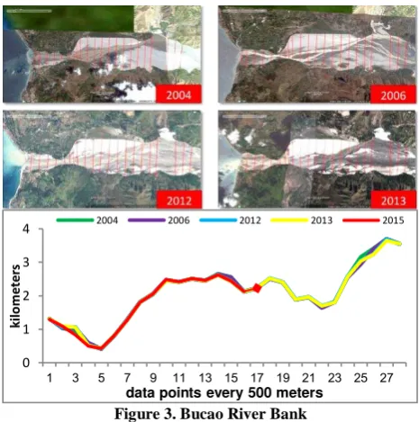
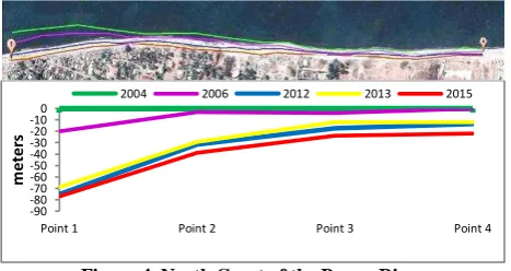
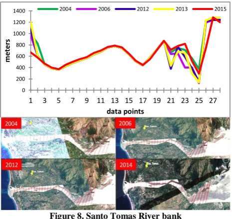
Results for both types of change in the coastal area of southern Albania from remote sensing data were later compared with the statistical data of migrations that happened since
Evaluation of spatial-temporal characteristics of vegetation in Kazakhstan is carried out by low-resolution satellite data on seasonal changes in the differential
This methodology allows us to compare European FUAs in terms of the spatial distribution of the land use classes, their complexity, and their structural changes, as well as to preview
We have exhibit the power of object-oriented analysis in image classification morphing the concept of Allometric relationship of features with a bit complementation of Euclidean
The threshold method is firstly utilized to obtain a coarse cloud detection result, and then the SVM classifier is used to obtain high accuracy of cloud detection..
The objective of this study is twofold: (1) determining the total burn severity of the Mersin- Gülnar wildfire in Turkey by using remote sensing based spectral indices, and (2)
In this investigation, the Phased Array type L-band Synthetic Aperture Radar (PALSAR) satellite remote sensing data were used to analyse major geological
Building change detection from very-high-resolution (VHR) urban remote sensing image frequently encounter the challenge of serious false alarm caused by