isprs archives XLII 2 W3 267 2017
Teks penuh
Gambar

Garis besar
Dokumen terkait
The International Archives of the Photogrammetry, Remote Sensing and Spatial Information Sciences, Volume XLII-2/W3, 2017 3D Virtual Reconstruction and Visualization of
4 BOOTSTRAPPING CONTINUOUS-TIME SLAM WITH GOOGLE’S SLAM SOLUTION For improving the Cartographer 3D mapping, the graph is es- timated using a heuristics that measures the overlap
The International Archives of the Photogrammetry, Remote Sensing and Spatial Information Sciences, Volume XLII-2/W3, 2017 3D Virtual Reconstruction and Visualization of
The International Archives of the Photogrammetry, Remote Sensing and Spatial Information Sciences, Volume XLII-2/W3, 2017 3D Virtual Reconstruction and Visualization of
England / English Heritage. The International Archives of the Photogrammetry, Remote Sensing and Spatial Information Sciences, Volume XLII-2/W3, 2017 3D Virtual Reconstruction
The International Archives of the Photogrammetry, Remote Sensing and Spatial Information Sciences, Volume XLII-2/W3, 2017 3D Virtual Reconstruction and Visualization of
The International Archives of the Photogrammetry, Remote Sensing and Spatial Information Sciences, Volume XLII-2/W3, 2017 3D Virtual Reconstruction and Visualization of
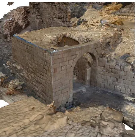
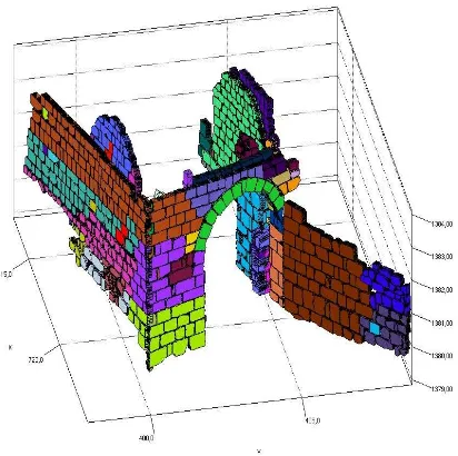
reference to a point cloud from NIKON D800 data The errors of the point cloud generated from video data relative to the points derived from the high resolution digital
