isprs annals III 3 379 2016
Teks penuh
Gambar


Garis besar
Dokumen terkait
DEFINING EARTH DATA BATCH PROCESSING TASKS BY MEANS OF A FLEXIBLE WORKFLOW DESCRIPTION LANGUAGE.. Constantin Nandra ∗ ,
We investigate a recently proposed concept where adjustment is performed using image observations limited to ground control and check points, so called fast aerial triangulation
The experimental results on the synthetic image data: (a) the original image with red border lines of clipped images with a 20% overlap between two adjacent ones; (b) the
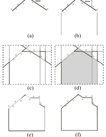
While partitioning method2 forces partition lines to follow building dominant directions and footprint corners.. Another large difference between the two methods is the area with
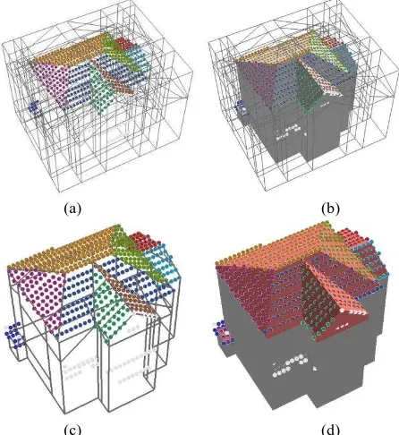
The automatic plane detection of each building is performed applying extensions of the RHT associated with additional constraint criteria during the random selection of the 3
Thus we can employ the pro- posed P-Linkage clustering method on the segmentation of point clouds, which differs from that on the 2D data points in three as- pects: (1) the
2.2.3 Slice Cutting Based Method: For both vertical and slanted pole-like street furniture especially thick poles that the two previous methods cannot extract, centre points
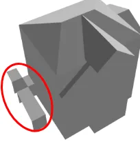
Although specifying the main filter direction along the surface normal and incorporating only limited number of neighboring points for filtering, artifacts are visible at some parts
