isprs annals III 8 159 2016
Teks penuh
Gambar

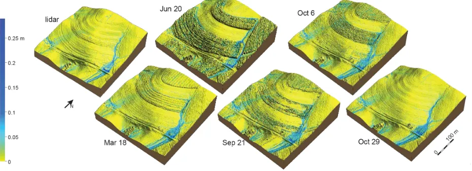
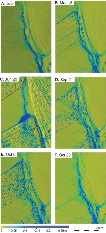
![Table 2: Comparison of lidar based DSM and sUAS derivedDSMs, RMSE – root-mean-square error [cm], mean – meandifference between lidar DSM and sUAS DSM [cm],](https://thumb-ap.123doks.com/thumbv2/123dok/3217001.1394735/6.595.115.230.657.737/table-comparison-based-deriveddsms-rmse-square-error-meandifference.webp)
Garis besar
Dokumen terkait
Additionally, it is evaluated how hyperspectral vegetation indices like the NDVI are effected by the angular effects within a single image and if the viewing geometry influences
Therefore, the objective of this study includes (i) investigating the relationship between carbon stocks and tree parameter (DBH, tree height, and crown diameter), (ii)
In this section, we describe our method for precise 3D see-through imaging (transparent visualization) of the large-scale complex point clouds acquired via the laser scanning of
KEYWORDS : Distributed computing, GIS processing, raster data tiling, data assimilation, remote sensing data analysis, geospatial big data, spatial big
Overview of the proposed reconstruction approach of regularized superstructures in low-density point clouds that has been integrated in the building reconstruction approach presented
In this paper we present a robust and efficient analytical pipeline for automatic urban scene classification based on point clouds from disparity maps, which is adapted to utilize
Thus we can employ the pro- posed P-Linkage clustering method on the segmentation of point clouds, which differs from that on the 2D data points in three as- pects: (1) the
In this section the rectification of the image triplets, dense matching with SG optimisation, subsequent sub-pixel interpolation and the calculation of 3D point clouds will be
