isprs annals III 7 187 2016
Teks penuh
Gambar
Garis besar
Dokumen terkait
To minimize the impact of the tree crowns represented in the raster on water flow modeling, we classified high vegetation and removed it from the point clouds using a
For the analysis, segments of point clouds from different heights along the stem were obtained from the tree stem. The segments were manually cleaned to only contain points
The number of lacunarity functions depend on the height of the vegetation (i.e., the vertical range of the point cloud).. The lacunarity function sets remain
This system includes several standalone tools that may be combined in different ways to accomplish various goals; that is, it may be used to perform a variety of tasks, as,
The improvement originates in an interpolation algorithm that generates a height map from sparse point cloud data by preserving ridge lines and step edges of roofs.. Roof planes
This study analyses the underestimation of tree and shrub heights for different airborne laser scanner systems and point cloud distribution within the
function under a\specified condition and within the specified time (Sinha, 1986). However, current research rarely provides objective and quantitative judgment on the
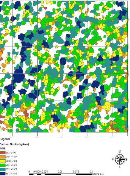
This study objective was to develop allometric relationships between tree size variables diameter at breast height DBH and tree height and leaf, branch, trunk, and total above ground
