isprs archives XLI B1 563 2016
Teks penuh
Gambar
Garis besar
Dokumen terkait
The approach consists of four major steps: the extracting of missing residential area from the remote sensing images with high resolution; the statistic analysing on the size
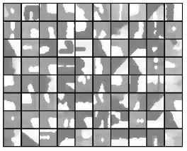
We extract the feature by the Caffenet from semantic regions cropped from LIDAR intensity images, and we select top K similar regions cropped from training
A NOVEL SHIP DETECTION METHOD FOR LARGE-SCALE OPTICAL SATELLITE IMAGES BASED ON VISUAL LBP FEATURE AND VISUAL ATTENTION MODEL.. Sui Haigang a, *, Song Zhina
The main steps of this approach include building segmentation, feature extraction and learning, and finally building roof labeling in a supervised pre-trained Convolutional
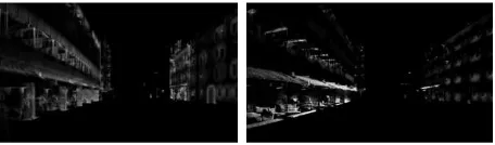
Due to the continuous technical advancement of Mobile Mapping System (MMS), it has become possible to acquire large number of images and 3d point cloud efficiently with highly
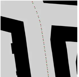
The constructed 3D point clouds from the laser scanner and the images for the first and the third data sets were used in the ICP registration to estimate the system
Different from the geometric rectification of airborne planar array images or multi linear array images, exterior orientation elements need to be determined for each
In object-based classification, the meaningful features are based on similar spectral or spatial properties of the remotely sensed imagery or the LiDAR data.. Applying an
