Conference paper
Teks penuh
Gambar
Garis besar
Dokumen terkait
Most of the current cadastral data models have been influenced by a very broad understanding of 3D cadastral concepts while this data model deals with
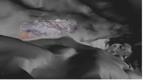
Figure 5 presents a preliminary result for our new approach for 3D surface reconstruction based on a combination of aerial and terrestrial images.. The set of 205 images contains
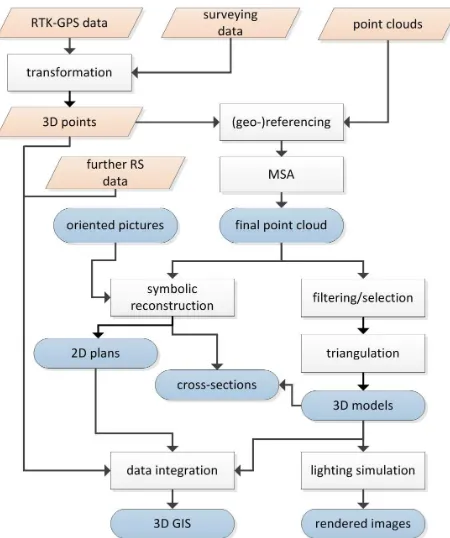
The geomatic techniques, especially range based (Terrestrial Laser Scanning – TLS) or image based (digital photogrammetry and image matching techniques) have specialized
During the data processing, the camera calibration and orientation was carried out by the software Agisoft Photoscans and the final result has allowed to achieve a scaled 3D model
However it is hard to acquire enough high dense point cloud and the internal camera of the laser scanner produce low quality images.. We introduce a possible technology of
Pu, Shi and Vosselman, George (2006), 'Automatic extraction of building features from terrestrial laser scanning', International Archives of Photogrammetry, Remote Sensing
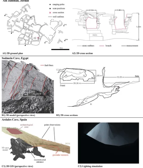
In this study we present a new concept where metric point clouds derived from national open airborne laser scanning (ALS) and photogrammetric image data are processed,
Optimised terrestrial biospheric carbon fluxes were derived using GOSAT data and its spatial and temporal variability was studied over India for the period June 2009 and
