isprsannals II 3 W4 33 2015
Teks penuh
Gambar

Garis besar
Dokumen terkait
In this study, we proposed a method to extract vegetation from terrestrial LiDAR data for estimating landscape index in urban areas.. The proposed method uses two different
The approaches applied for this purpose were (i) to optimize the degree of filtration with respect to the field measurements, and (ii) to predict this degree by means of
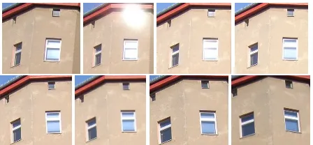
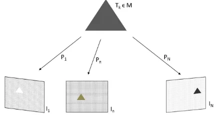
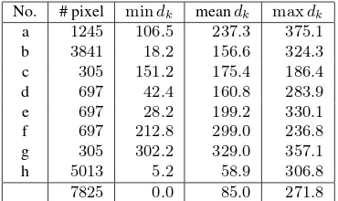
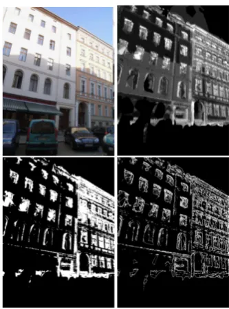
For checking visibility constraints, meaning to check which building elements are visible based on the rays from the cameras to the reconstructed points, a voxel grid with cells of
Experimental results from using five sets of PRISM triplet images taken of the area around Saitama, north of Tokyo, Japan, showed that the average planimetric and height errors in
Without ever mentioning the term USTs, different research groups have tried to distinguish types of urban settlements based on medium-resolution Synthetic Aperture
Only the images captured on the “Stadthaus”, obelisk and the square will be considered in this dataset (the data from the city hall will be kept back for the next
The results show that in the case of a higher geometric accuracy in the SAR images than in the optical image the achieved center positions of the roundabouts from the SAR image can
This paper reports an analysis conducted in order to investigate the measurement precision and accuracy of the centre location of an ellipse on a digital image by
