isprs archives XLI B3 351 2016
Teks penuh
Gambar
Garis besar
Dokumen terkait
Then, use the road texture points to extract the road segments. Build buffer around key points with radius of 8, about one quar- ter of the road width. If the segments and the
The last step consists in projecting the hy- perspectral data using this new navigation data and performing a last correction, taking into account the boresight between the
1) The initial building contours are extracted from the classification results of LiDAR point cloud. 2) The internal energy and area energy of the initial contour are
The first is the classification of the indicators of mine presence in surface (less compact objects: trench, surface embankment, fords) and linear objects, and the
Several dictionaries, on the basis of which the data are reconstructed, are selected randomly from cloud-free areas around the cloud, and for each pixel the dictionary yielding
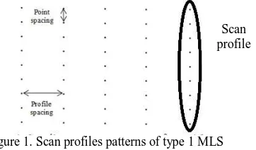
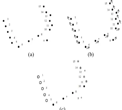
The fundamental problem is to determine the correct approach to determine the size and orientation of the local normal plane of The International Archives of
The next subject of the analysis was glass bottle of perfumes with a different type of glass. During the scanning, it was observed that the glass objects are
Since 2010 the Land Surveying Office and VGHMÚ has been using for the orthogonalization of aerial survey photographs the recently created digital terrain model of the Czech
