isprsarchives XL 7 W3 627 2015
Teks penuh
Gambar

Garis besar
Dokumen terkait
This paper aims at zoning forest fire potential of Gulestan Province of Iran forests utilizing Remote Sensing, Geospatial Information System, meteorological data, MODIS
As shown in Table 2, the fractal dimensions for colors values of natural landscape images is also obviously smaller than that of urbanscape images.. Fractal dimensions for colors
Each of these applications requires detailed and high quality input data from different sources like satellite data, aerial images and ground-based information from
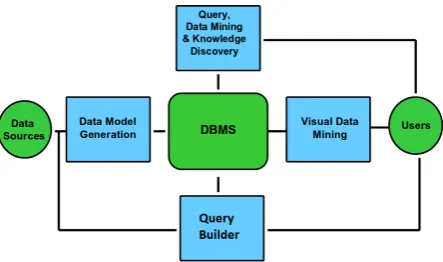
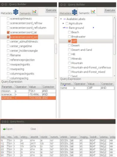
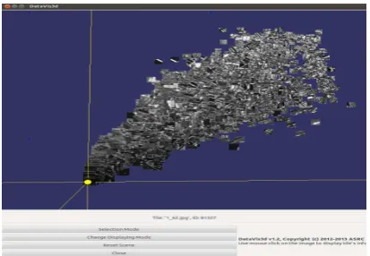
A web interface that enables user-friendly spatiotemporal queries is implemented at the front- end, while a series of data mining functionalities extracts aggregated
Landsat images from 1977 to 2014 and water discharge data were analysed to find out a relationship between dynamics of erosion and accretion for different time intervals with
The CQC harmonisation task seeks to ensure coordination to facilitate EO data consistency and interoperability across Copernicus communities and for the benefit of
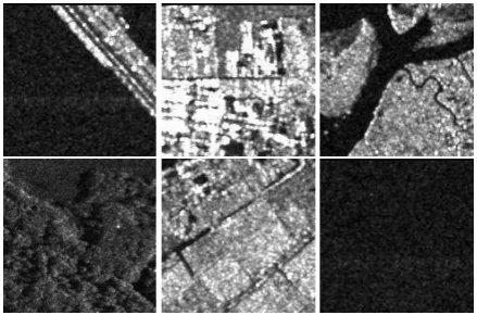
Satellite data also included a set of TanDEM-X (TDX) and TerraSAR-X (TSX) X-band synthetic aperture radar (SAR) images, suitable for interferometric and
With the rapid development of sensor networks and Earth observation technology, a large quantity of disaster-related data is available, such as remotely sensed
