isprs archives XLI B7 549 2016
Teks penuh
Gambar
Garis besar
Dokumen terkait
Finally, the high resolution image and marker image as well as super- pixels are employed as input of Maximal Similarity based Region Merging (MSRM) to group the
From the model based analysis it followed that error residuals of general or common models can be used as quality assessment measures of multi-resolution image fusion methods in
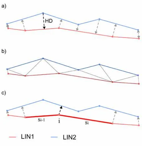
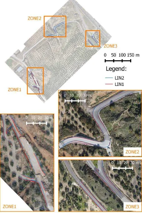
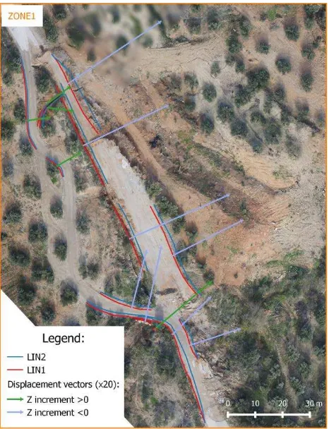
The results of the application of a methodology for an integrated orientation into a common reference system using data obtained by LiDAR systems, digital and
It combines saliency analysis and feature learning to extract semantic information to improve the detection of harbour on high resolution remote sensing
Building change detection from very-high-resolution (VHR) urban remote sensing image frequently encounter the challenge of serious false alarm caused by
In this study, high-resolution satellite images of Van-Ercis, acquired by Quickbird- 2 (© Digital Globe Inc.) afte r the earthquake, were used to detect the
In this study, the classification of greenhouses was performed by using object-based image analysis method with high- resolution satellite images.. This study
With frame camera technology, when capturing images with stereoscopic overlaps, it is possible to derive 3D hyperspectral reflectance information and 3D geometric data of
