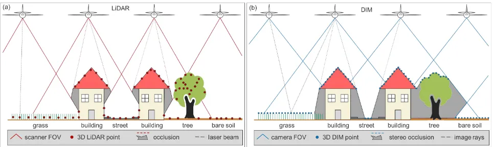
isprs annals IV 2 W4 259 2017
Teks penuh
Gambar
Garis besar
Dokumen terkait
Advanced Modeling Technique (AMT) has led to combine existing data (point clouds) with structural databases of 3D objects, ensuring adequate three-dimensional
Simulated results reveal that the large number of 3D points used for image orientation has very limited impact on network
These results demonstrate how structure-and-motion and multi- view stereo algorithms can be successfully applied to create high detailed dense point cloud, 3D models and
A simplified Persistent Scatterer Interferometry (PSI) approach is used to monitor the displacements of the Nanjing Dashengguan Yangtze River High-speed Railway
Based on the indoor mapping schema IndoorOSM (Goetz and Zipf, 2011), we develop an algorithm to support generation of 3D building models using OSM data, and build a web application
This approach can be seen as fusion of location fingerprinting and trilateration as the currently determined radio maps are used to derive the ranges to the access
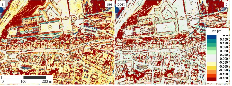
In order to quantify changes in the rock slopes after the wave attack, a terrestrial laser scanner was used to obtain 3D coordinates of the rock surface before and after each
The objectives of this study are to develop a new method for sin- gle tree stem detection based on high density ALS data using (i) point and object part level 3D shape descriptors,
