isprs archives XLI B7 443 2016
Teks penuh
Gambar
Garis besar
Dokumen terkait
This study evaluated the relative geo-location accuracy of the TerraSAR-X ortho-rectified EEC product by the pixel matching methodology using the pairs of intensity
The achieved velocity values range from 10 to 25 meters/month and they are coherent to those obtained in previous studies carried out on the same glaciers and the results highlight
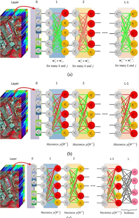
In this paper, a new method has been presented for the extraction of edge information by using Differential Search Optimization Algorithm.. The proposed method
The identification of the same boulder at two different epochs that allows to perform automatic 3D or even 2D matching may be The International Archives of
Two ship models, the “V” ship head model and the “ || ” ship body one, are proposed to localize the ship proposals from the line segments extracted from a test image, which
The International Archives of the Photogrammetry, Remote Sensing and Spatial Information Sciences, Volume XLI-B7, 2016 XXIII ISPRS Congress, 12–19 July 2016, Prague, Czech
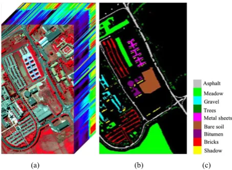
Therefore, the objectives of this study is to analyze the spectral properties of the land cover in the shadow areas by ADS-40 high radiometric resolution aerial images, and
The International Archives of the Photogrammetry, Remote Sensing and Spatial Information Sciences, Volume XLI-B7, 2016 XXIII ISPRS Congress, 12–19 July 2016, Prague, Czech
