isprs annals III 3 209 2016
Teks penuh
Gambar

Garis besar
Dokumen terkait
The estimated coastline in most of cases needs improvement because of some random factors across the coastline, such as people, moving cars, or waves, which
The band selection proposed by this work is based on two steps: On the one hand, the correlation of classification maps based on single bands (Figure 1 shows the
To well process the dense striped data and ensure a reliable solution, we construct a statistical property based constraint in our proposed model and use it to control the
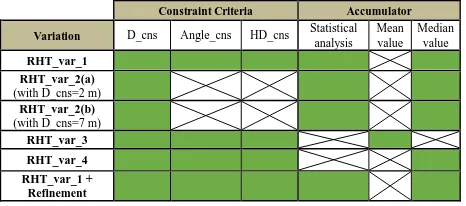
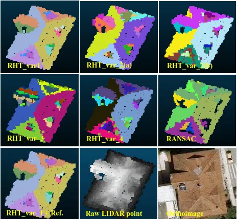
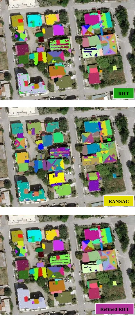
The detection of planes in the point cloud is conducted by apply- ing an algorithm developed in the frame of a study by Miernik et al. The algorithm is implemented in a
The focus of the experiments is to assess the advantages and dis- advantages of the automatic registration relative to manual Image- to-Geometry registration methods that are
Automatic assessment of data acquisition and transmission losses has helped in quick quality tagging of browse images which is extremely useful for the users
The major improvements by taking not only a single band into account as typically realized, but multiple bands combined with additional external geo-information data such as of
Feature extraction is the first step of the registration task. The selection of salient features should consider the properties of the datasets used, its application,
