isprsarchives XL 7 W3 157 2015
Teks penuh
Gambar
Garis besar
Dokumen terkait
While the synergy between thermal, optical and passive microwave spectra observations is well known for vegetation parameters and soil moisture retrievals, the experiment aimed
Spectral vegetation index evaluation is affected by the presence of shadows in the scene, so the authors considered necessary shadow detection and removal
A calibration dataset of Sentinel-2 Level-1C products is constituted, covering different land cover types (e.g. snow, rocks, desert, urban, vegetation, grass, forest, cropland,
Provided the differences seen in the yearly and daily estimates are in fact related to vegetation changes across the different years, the quality of the soil moisture retrieval
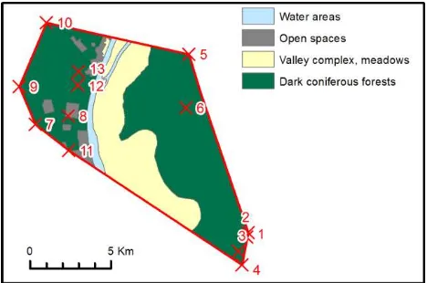
As a result, the 50 initial vegetated categories were consolidated into the following categories: Alpine Vegetation; Evergreen Coniferous Forest; Deciduous
KEY WORDS: Vegetation Coverage, Relative Leaf Area Index (RLAI), Normalized Difference Water Index (NDWI),
Ground reference data of leaf area index (LAI), chlorophyll (SPAD) and nitrogen (N) concentration of winter (WW) and summer wheat (SW) and corresponding RapidEye imagery.. Site-ID
Recent studies have demonstrated the feasibility of estimate chlorophyll content from hyperspectral vegetation indices composed by the reflectance of specific bands
