isprsarchives XL 7 W3 707 2015
Teks penuh
Gambar

Garis besar
Dokumen terkait
This paper therefore investigates the use of the box-counting method in three dimensions using simulated ‘range-to-hit’ and airborne LiDAR data and investigates
The goal of this project is to use Earth Observation to support the needs for the monitoring, mapping, and water resource potential evaluating of glacier change in the Yigong Zangbo
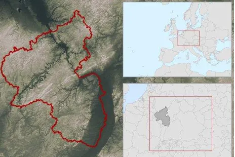
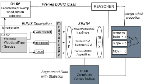
available in regular soil survey reports the use of these properties for defining and mapping ESAs requires the definition of distinct classes with respect to
1995). Recently, SVMs have been successfully applied in the classification of hyperspectral remote-sensing data. Camps- Valls in 2004 proposed an automatic algorithm
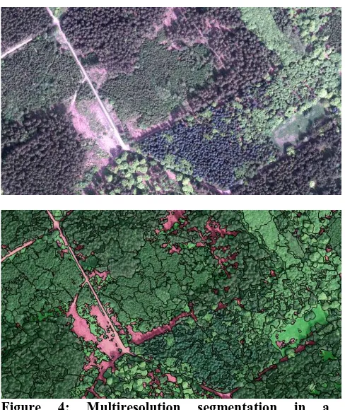
In order to achieve sustainable urban land use and an appropriate provision of ecosystem services, the monitoring of urban vegetation must be reflected against the background
The results determine the change of land use/cover and land surface temperature in Danang city by using multi-temporal Landsat and ASTER data for the period of
The aim of this paper is to present a novel method of time series ENVISAT ASAR WS mode data analysis as well as develop a phenology-based classification approach for mapping
The approach combines different neural networks (NNs) architectures to restore missing values in a time-series of satellite imagery and provide supervised classification for crop
