isprsarchives XL 3 W3 45 2015
Teks penuh
Gambar
Dokumen terkait
KEY WORDS: updating, DSM, LiDAR, high resolution satellite images, 3D change detection, automatic building
It includes LiDAR data and aerial orthophotos in the RGB color space (Fig. 1) LiDAR data was acquired by the GeoIntelligence SA over the above area and is in the form
The Phil-LiDAR 2 Program is a 3-year program funded by the Philippines ’ Department of Science and Technology (DOST) to provide detailed resource inventory using LiDAR and
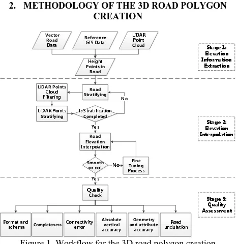
For example, create ground plan of high point cloud density and extract contour line data of 3D point cloud data by create layer that has been divide height. Also, 3D
Fig 7: Input tree points, colour coded according to height Where necessary the components are subdivided into individual trees by detecting whether at knee height (0.5-1 meter above
Flight planning also needs to be created with more precision to avoid overshoot in the sampling plan (see Figure 5, top) and error in the estimation of sampling rate. Loading
Through co-registering optical image and InSAR point cloud to a common reference 3-D model, we are able to relate the semantic meaning extracted from the optical image to the
Update: The above credibility resulted from integrating the crowdsourced data will be used to update the initial credibility values assigned to the individual
