isprs archives XLI B8 1127 2016
Teks penuh
Gambar
Dokumen terkait
Using multi-agent based simulation model, the future urban land use optimization allocation was simulated in 2020 and 2030 under three different scenarios.. This kind of
As such, the study has set its objectives as follows: (1) developing a knowledge-based image classification approach to detect urban wetlands at fine scales
Finally, stand volume was estimated and mapped using aerial photo stand volume equations by species which have two independent variables, crown density and stand height.. South
KEY WORDS: Crown Delineation , Canopy Height Model (CHM), Local Maxima, Curvature, Slope, Thiessen
Using a custom notch filter on the camera sensor during UAV image acquisition does not yield better height accuracies, the better results with NIR band for
If, as one of the basic assumptions, the existence of connection between dry intrusions, dry bands, tropopause height and warm dark areas distribution on water vapor images (WV
The three robots are equipped with stan- dard sensors for navigation and obstacle detection (GNSS, IMU, ultrasonic sensors, navigation cameras) as well as special sen- sors
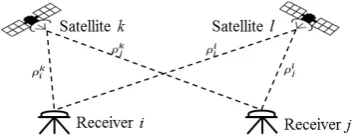
A mobile laser scanning system has certain components: a Global Navigation Satellite System (GNSS) receiver and inertial measurement unit (IMU), providing platform
