isprs archives XLII 1 W1 211 2017
Teks penuh
Gambar

Garis besar
Dokumen terkait
This paper discusses the accuracy of tree inventory data including the tree location, diameter at breast height (DBH), height and tree name contributed by indigenous people using
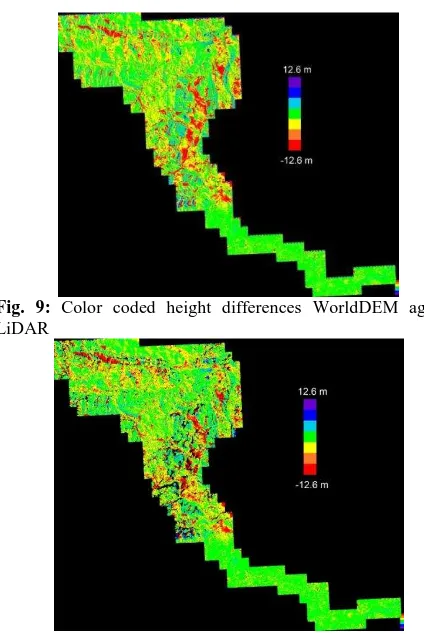
Generally, the results of fusion based on height error maps deliv- ered with the TanDEM X data and the standard deviation maps of the Cartosat 1 stereo matching confirm the
LP360 Tutorials. GIS and Decision Making in Local Government. Redlands, California, USA. Making Better Use of Acuracy Data in Land Change Studies: estimating Accuracy and
3 that on average, the set of variables recommended by the forward selection method of logistic regression results in a slightly worse classification accuracy by means of random
The presented algorithm is based on interpolating smooth intensity raster surface from LiDAR point cloud data using point thinning process.. The interpolated surface is
Similarly, the accuracy assessment of the orientation of linear features used statistical Mean and standard deviation of the difference between the coordinates of road
In view of the latest development of multispectral LiDAR sensor, a more generic approach should be developed so that the radiometric correction model is capable of handling
The three-stage inversion algorithm based on random volume over ground (RVoG) model describes the relation of forest height and polarimetric interferometric
