isprs archives XLI B3 769 2016
Teks penuh
Gambar
Dokumen terkait
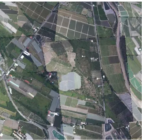
In this process, we firstly use CloudCompare to generate the rectified images from CMVS files, then, stitching them into mosaic image using Microsoft ICE.. Figure 5 shows the
Time-based RFM and sensor corrected images RFM were proposed to solve the low fitting precision caused by exposure time changing in some orbiters, such as CE-2 and
For example, at flight altitude of 150 m and in case of absolute attitude determina- tion, the improved attitude determination through VDM/INS/GNSS integration would reduce the
Aside from texture mapping 3D building reconstruction from aerial images involv- ing parametric shapes, point cloud segmentation or the simplifi- cation of digital surface models
In order to deal with aerial images and improve the matching accuracy a novel optical flow field based dense matching methods for aerial image is proposed in this paper, which is
Then, 3D structure lines are obtained from the 3D cloud points acquired with 3D cameras and projected onto the 2D images to generate 2D structure lines, which are combined with the
From the rock-fall risk analysis based on the slope, we could ascertain that the protruding rocks detected by the proposed algorithm and also confirmed by
platform, it is mostly scanned in its ajar position. In other words, this connection element which provides continuous accessibility between scanning positions turns out to be
