isprs archives XLI B7 529 2016
Teks penuh
Gambar

Dokumen terkait
Hyperspectral data acquired by EO-1 hyperion sensor proved resourseful to carry out the mineral mapping as many significant altered minerals were identified in this area,
We present FUTURES (FUTure Urban – Regional Environment Simulation) – a patch-based, stochastic, multi-level land change modeling framework as a case showing how what was once a
This study demonstrates the possibility of detecting the changes of growing stocks in mountainous forest stands derived from ALOS PALSAR and PALSAR-2 images. Owing to topographic
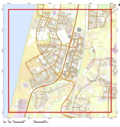
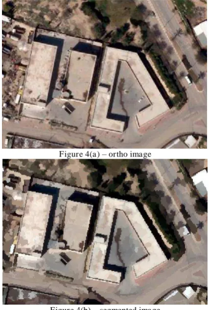
Two main processes were involved: (1) automatic extraction of building roofs using the integration of LiDAR data and aerial imagery in order to derive its’ outline and areal
Focusing on this issue, the mainly contribution of this paper is to propose an automatic optical-to-SAR image registration method using –level and refinement model: Firstly,
We are grateful to the USGS and the South African National Geospatial Information (NGI) of the Department of Rural Development and Land Reform for the provision of
The identification of the same boulder at two different epochs that allows to perform automatic 3D or even 2D matching may be The International Archives of
The National Land Survey (NLS) has had a digital topographic database (TDB) since 1992. Many of its features are based on the Basic Map created by M. First new version
