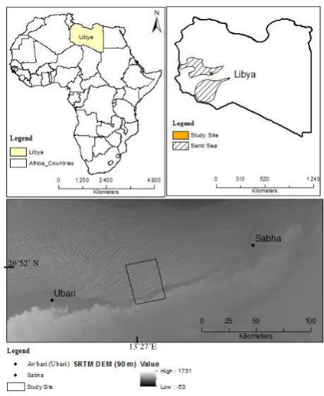
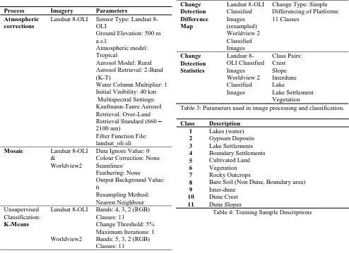
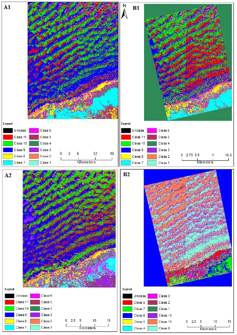
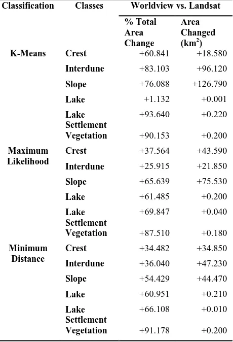
isprsarchives XL 7 W3 1375 2015
Teks penuh
Gambar
Garis besar
Dokumen terkait
In order to assess the potential of using surface water irrigation in the delta area of Bangladesh, we used a series of Landsat images to analyze current cropping
(2012) to calculate the annual average shoreline on dynamic beaches through information provided by the Landsat satellite data, and comparing the results with those
Landsat images from 1977 to 2014 and water discharge data were analysed to find out a relationship between dynamics of erosion and accretion for different time intervals with
Some examples are provided on the infor- mation extracted from satellite data by the GHSL project, includ- ing preliminary results obtained from the processing of the global
The classification approach described below (see 2.5.1) makes use of indicators. They describe every single habitat class of the classification scheme. The use of such
Forest cover change analysis for the AOD (example: sample unit South 10°, West 58° in Northern Mato Grosso State); upper line: Landsat MSS, TM, ETM and OLI imagery for the
The comparison of Landsat change maps of accumulative annual changes and direct changes between 2005 and 2010 (Table 6) shows the expected pattern: a high error for direct changes
In 2011, assessment was conducted using a combination of Landsat (5 and 7) and for the first time, 5m high resolution imagery, with RapidEye coverage for approximately half of
