isprsannals II 3 W5 393 2015
Teks penuh
Gambar


Garis besar
Dokumen terkait
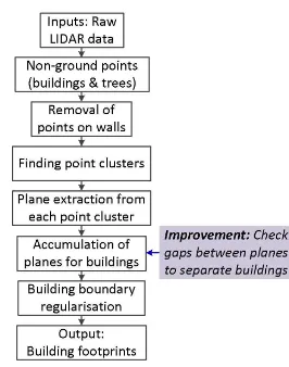
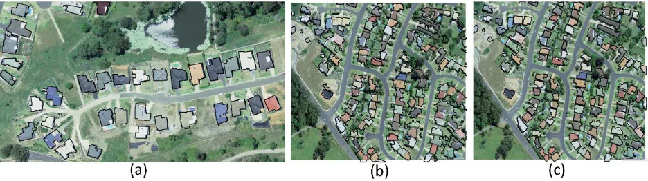
Buildings are usually characterized by vertical walls that define the footprint of each building and can be reconstructed using image matching on oblique
Sec- ond, the rainfall data measured by the municipality stations are used as ground-truth to validate the values approximated from the ARPAL data set: in this setting,
Result at the system level Overall, we load several billion points into the point cloud server, perform several processing in and out of base ( s to hour), extensively use simple
Abnormal activities of Jaywalking are successfully detected as shown in Figure 4(b) and (c). The principle for this detection is also because of the percentage of the
The SPR process determines the extrinsic camera parameters such as the position and attitude at the acquisition time of an image using the ground control points (GCP).. Since
Another approach similar to this has been proposed which does not need the clutter ground truth labels (Wang et al., 2010).. In this paper, we tackle the problem of indoor
c) the matched candidate points.. Examples of reconstructed objects, a) for toeboard. In Figure 14a, the green points are original points of the divided building façade, while
On the other hand, the problem of extracting a DTM from laser scanning is widely studied, the main challenges being the registration of overlapping strips, the filter- ing of ground
