isprs archives XLI B8 1263 2016
Teks penuh
Gambar
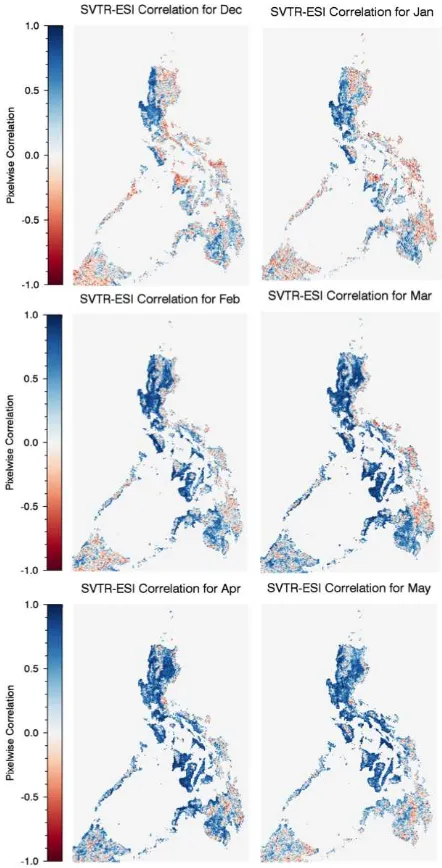
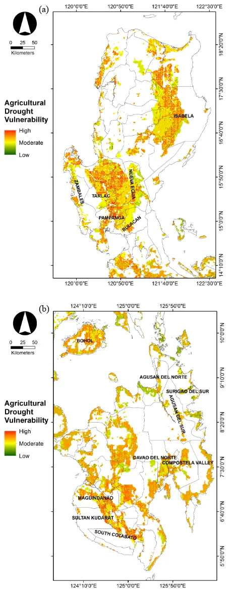
![Figure 1. Maps of (a) ESI [5.6 km] and (b) SVTR [5.6 km] for](https://thumb-ap.123doks.com/thumbv2/123dok/3277380.1401877/2.595.307.533.74.362/figure-maps-of-esi-km-and-svtr-for.webp)


Garis besar
Dokumen terkait
Mapping Robinia pseudoacacia Forest Health Conditions by Using Combined Spectral, Spatial and Textural Information Extracted from IKONOS Imagery and Random Forest
consumers’ intention. Finally, we presented an integration method for the dynamic composition of land cover web services based on the matching of request parameters and
This means that LIDAR will play an important role in regional-scale biodiversity monitoring (Zlinszky et al., 2015b). The original study aimed to create proxies for all
Visual interpretation was mainly used. We distinguish land cover types under the help of direct interpretation keys combined with indirect interpretation keys such
The rich spectral context of the multispectral image is combined with the high spatial resolution of the panchromatic image, applying image fusion – pansharpening, facilitating in
This study utilizes vegetation maps derived from Terra/MODIS data to generate a model of current climate conditions suitable to beech-dominated deciduous forests, which are
Finally, stand volume was estimated and mapped using aerial photo stand volume equations by species which have two independent variables, crown density and stand height.. South
Based on RS-composite classification, DEM-based forest growing conditions types and field data the maps of forest cover and forest ecosystem carbon stock were created...
