isprsarchives XL 7 W3 1395 2015
Teks penuh
Gambar

Garis besar
Dokumen terkait
In this framework, the main objectives of this study are: (1) To introduce a software tool (IndiFrag) for the extraction of urban LULC metrics at different levels and
A calibration dataset of Sentinel-2 Level-1C products is constituted, covering different land cover types (e.g. snow, rocks, desert, urban, vegetation, grass, forest, cropland,
On the one hand side the mapped avalanche debris was punctuated by small holes (i.e., errors of omission); at the same time many areas, especially wind-blown areas and rock
Mangrove and littoral forest average erosion is higher than no-forest and urban areas because the presence of water in the area resulted in a lower NDVI, which resulted
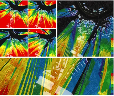
KEY WORDS: Land surface temperature; Ground coverage ratio; Building volume density; Urban heat island; Landsat
According to the unique feature of radiance fog from its generation to dissipation, especially considering the difference between clouds and fog during their lifecycle,
In our study we classified grassland vegetation types of an alkali landscape (Eastern Hungary), using different image classification methods for hyperspectral data.. Our aim was to
Our study contains two main parts: urban viaducts recognition and topology reconstruction. The International Archives of the Photogrammetry, Remote Sensing and
