isprsarchives XL 3 W3 535 2015
Teks penuh
Gambar
Garis besar
Dokumen terkait
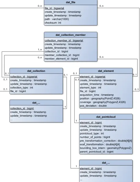
By appropriate additional field measurements, point clouds can be referenced to a common reference systemwith high accuracy,so thatscans effectively share the
This paper describes how several critical parameters of individual deciduous trees can be extraced from airborne multi-aspect TomoSAR point clouds: First, the point cloud is
COMPARISON OF FIELD AND AIRBORNE LASER SCANNING BASED CROWN COVER ESTIMATES ACROSS LAND COVER TYPES IN KENYAJ. Pellikka
It can be observed that, in the south part of the domain, MB and RMSE are higher, reaching values between 0.5 and 0.9 this could be related to the fact that CAMx simulated
Mapping of topsoil properties using Visible, Near-Infrared and Short Wave Infrared (VNIR/SWIR) hyperspectral imagery requires large sets of ground measurements for calibrating
The resulting procedure, bringing together UAV survey data and geological information on the structural features that generate the hazard, allows for in time monitoring the
In fact, the availability of an application using location data depends on the integrity of the location data (Yabuki, 2013), and the integrity of the location data strongly
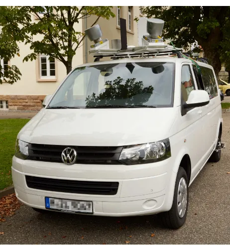
The algorithm is divided in three main steps: road segmentation (based on a PCA analysis of the points contained in each cross-section of collected by a mobile
