isprs annals III 3 19 2016
Teks penuh
Gambar
Garis besar
Dokumen terkait
Height feature is the important feature of the building, but post-disaster remote sensing images have only rich texture rather than height feature. In order to obtain the
(Inamdar et al., 2008) applied the method proposed in (Piti´e et al., 2007) to use with multidimensional data i.e., mul- tispectral satellite images. Particularly, the N-D
The evaluation employs the absolute difference his- togram (the histogram of the 1.38 µ m method and the CTM de- cirrus results difference), the relative difference histogram
To efficiently represent the spatial-spectral feature information around the central pixel within a neighbourhood window, the unsupervised convolutional sparse
In order to establish the concentric image acquisition, the camera mount must be calibrated so that the projection centre of the camera is located at the rotation centre of the
UHI are seen as field objects whose thematic at- tribute is the temperature intensity defined by the difference with a threshold temperature observed in rural areas at the same
The bundle adjustment model is based on some polynomial correction functions, enriched with a physical constraint that introduces the notion of a global sensor rotation into the
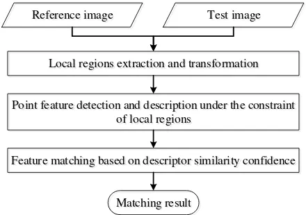
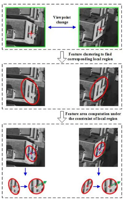
Feature extraction is the first step of the registration task. The selection of salient features should consider the properties of the datasets used, its application,
