isprs archives XLII 2 W6 229 2017
Teks penuh
Gambar


Dokumen terkait
- obtained value of standard deviation for the coordinate XYZ from both models of prediction does not exceed acceptable criterion of 10 m for locating the accuracy
The above case studies highlighted the importance of some of the characteristics of a spatio-spectral camera using stepwise line filters, such as the
Results from feature reduction analyses suggested that four spectral regions were important for wetland species discrimination. In terms of feature reduction
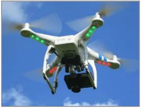
In order to classify, available camera systems can be grouped into the following categories: proprietary cameras (like DJI systems on Phantom or Inspire platforms),
The aim of this paper is to investigate the influence of interior camera orientation, tie point matching and ground control points on the resulting accuracy of bundle adjustment
1). Too much footprint noise from roads, concrete land and vegetation due to the fact that it only provides RGB bands. Inability to distinguish wall boundaries for landed
The month which has the most increase in salinity indices values in bare soils and the most reduction in vegetation indices values in vegetation lands is considered the
The suitability of UAV-based photogrammetric point clouds and hyperspectral imaging was investigated in mapping biodiversity indicators such as structural complexity
